Feltham Pond 1907
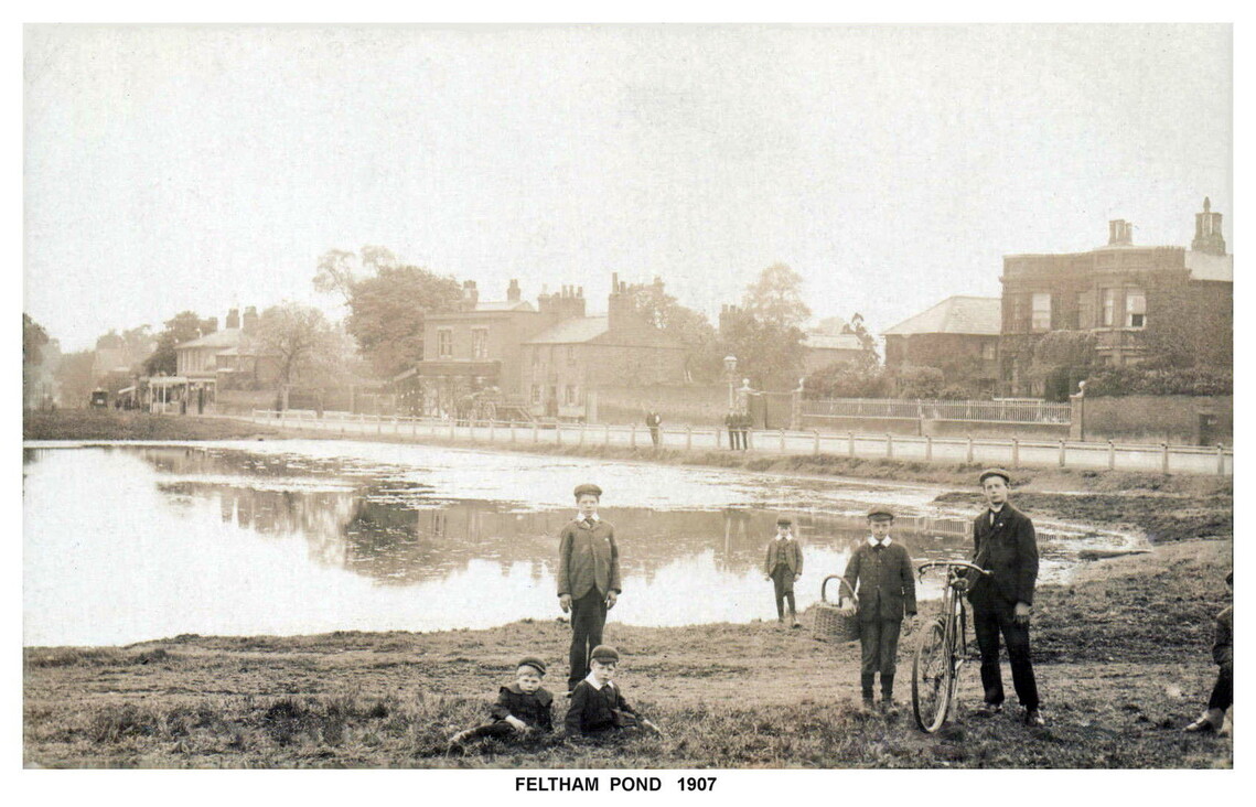
Feltham Pond (or Duck Pond) is the orginal and oldest village pond out of the three remaining ponds in Feltham. It was mentioned in the licensing of Feltham's oldest pub 'The Red Lion' in 1722, which stands on the corner of Browells Lane opposite the pond, now named KTM Rox.
Many centuries ago, Feltham village was part of Hounslow Heath, which was covered in ponds. Feltham Pond is the last heathland pond still remaining.
Here is a short write up from James Marshall who was once head of Hounslow Local Studies Dept for over 30 years.
**************************************************************************************************************************************************
Here is an extract from General Roy’s Baseline Map of 1784:
General Roy’s Baseline was laid-out over the full length of Hounslow Heath. The line was carefully measured to provide the very first measurement for the surveying and mapping of Britain by the Ordnance Survey. The map also shows the boundary between the fertile farmer’s fields and the infertile, grassy gravel of Feltham Common, which was once a part of Hounslow’s great heath – that part within the boundaries of Feltham parish. The map has the letters ‘OUNSLOW’, from Hounslow Heath, and ‘FELTHAM PARISH’ over-printed on the heathland area where there is no significant detail that they might otherwise obscure. You can see that the village of Feltham, in 1784, stretched up the High Street just as far as the green and the junctions of Hanworth Road and Hounslow Road with the High Street. The Victorian town that grew up around the railway station does not yet exist.
Moses Glover’s map of 1635 describes the heath as ‘cold, spewie, and full of springs’. The heath gravels had a high water table – they were saturated with groundwater that could be found close to the surface. So, hollows often became ponds. And ponds could be found all over the heath. Feltham Pond, on Feltham Green is a surviving example of a former heathland pond. It is right on the edge of the old heath, where the better soil of the fields surrounding Feltham began. The town grew up around the green in Victorian times and it became incorporated into the townscape as a valued park and open space.
Extract from General Roy’s Baseline Map of 1784, showing Feltham and Hounslow Heath.


FELTHAM PARISH : THE ENCLOSURE MAP OF 1800. FELTHAM GREEN POND SITS RIGHT ON THE BOUNDARY OF THE INFERTILE COMMON HEATHLAND AND MORE FERTILE ARABLE FIELDS AROUND THE VILLAGE
The crudely highlighted Enclosure Map of Feltham parish from 1800 shows how neatly the mediaeval village sat in the centre of its three common fields: Highfield, Middle Field and Low Field. This gave the villagers of Old Feltham convenient access to each of the three fields that they farmed together. Does this reinforce the ‘village-in-the-fields’ derivation?
ENGLISH PLACE-NAME SOCIETY: SURVEY OF ENGLISH PLACE-NAMES, 1923-2022
http://epns.nottingham.ac.uk/browse/Middlesex/Feltham/
Feltham
The name is possibly a compound of feld, 'open space' and ham, with the same unvoicing of final d to t before h as in Up Waltham (PN Sx 77). See further Ekwall in Studia Neophilologica i, 97 ff. Neither form can be taken as representing an OE original with any accuracy. Each comes from a charter which is a fabrication of the Norman age.
Alternatively, the first element might be a plant-name felte , a derivative of OE felt , 'felt,' found in certain plant-names and taken by Ekwall (DEPN) to be the first element of Feltwell (Norfolk).
FELTWELL (Norfolk)
The Spring where wild marjoram, or mullein, grows, Old English: felte + well
The precise botanical species is uncertain. Here the soil is sandy chalk, which would favour marjoram.
[The Cambridge Dictionary of English Place-Names; Victor Watts; Cambridge university Press 2004.]
MULLEIN [Chambers Dictionary]
Tall, stiff, yellow-flowered, wooly plant, genus VERBASCUM. Popularly known as Hag’s taper, Adam’s flannel, Aaron’s rod or shepherd’s club.
**************************************************
The island in the middle of pond is man made and was created in 1865. The first tree on the island was a black poplar, planted in 1903 (pictured below, before the island was incased by brick work). The black poplar was replaced when it blew over in a storm by an elm, which did the same. A willow tree was then planted, which still stands (so far).
In the early 19th century, councillors of Feltham Urban District Council determined the pond was 'smelly' and twice threatened to fill it. The frist time was when a bridal path at Hanworth park was being created by the military and they agreed to partially fill around the edges of the pond. The second time they wanted to completely fill it to create a children's play ground. The Chair of the Council disagreed, however, and decreed it should remain a place for all residents to enjoy.
A concrete skirting was put in and the pond was connected to the Longford River in the early 1960's so that fresh water could be put into the pond to top it up whenever water levels became too low during hot summer periods. Feltham Pond is the only pond connected to a water source. The other two ponds were formed by 'borrow pits' excavated for gravel. Bridge House Pond was excavated to build the railway bridge in 1848 and Clymping Dene Pond was excavated for gravel to mend the parish roads. These ponds are fed by rain water.
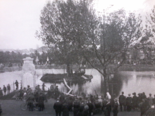
Pictured below: A sunny May bank holiday in the 1920's. A brass band would play on the island, accessed by planks of wood placed across the pond.
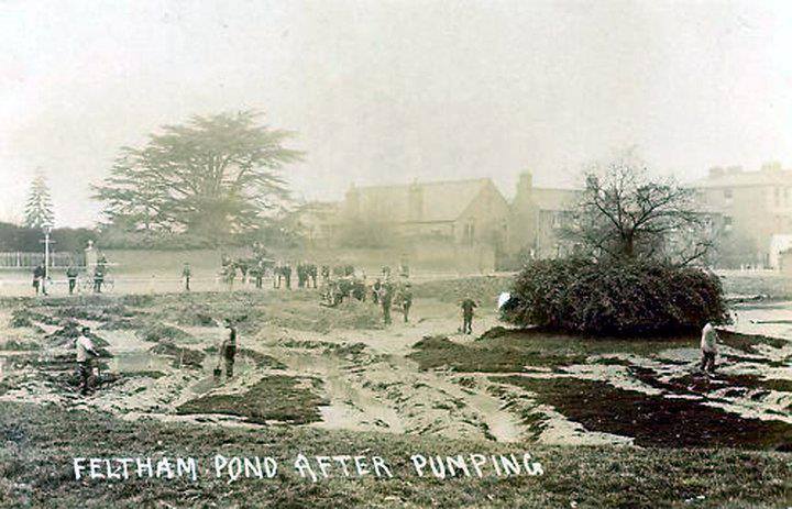
In 1964 the pond was drained and dredged by Feltham Urban District Council (pictured below). It wasn't drained or desilted again until Octorber 2019 by Hounslow Council (pictured below).
